For business & institutions

Ground-level facts from every farm you rely on.

Verified field data and satellite coverage at scale, so you know what is happening across hundreds of farms without driving out to each one.

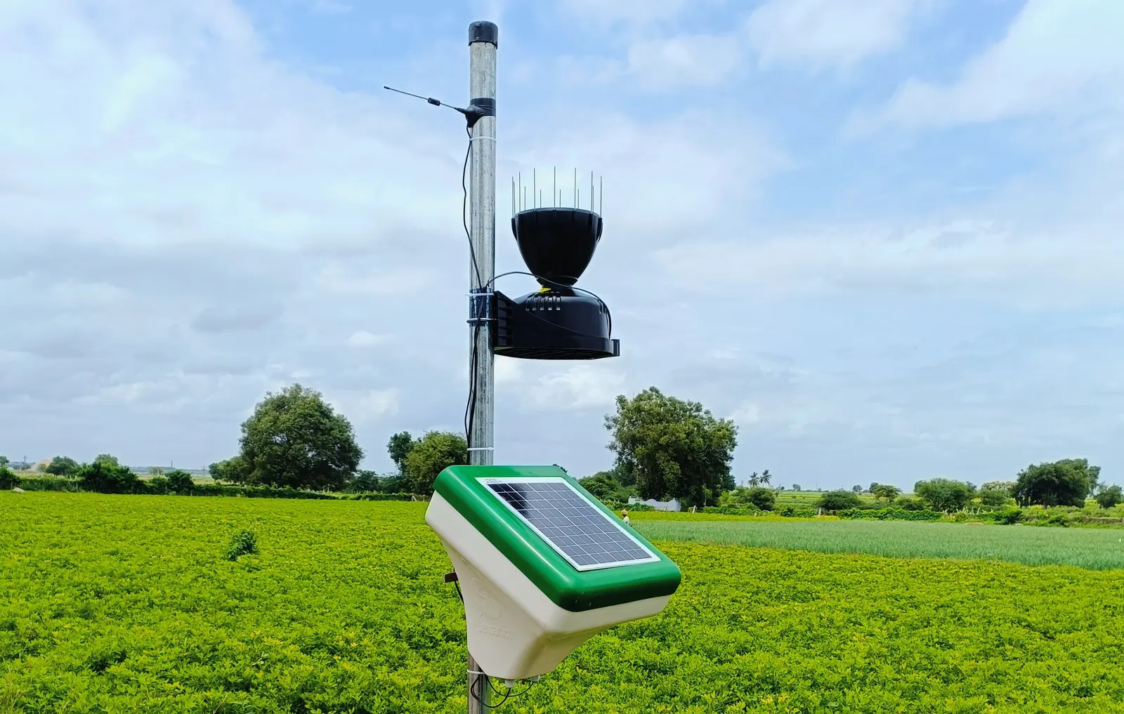
A field weather station on a pole above a green crop, with a solar panel and rain gauge.

Who we work with

Made for the teams accountable for the crop.

Whether you buy from farms, support them, insure them or study them, you need evidence you can rely on.

Agribusiness & exporters

The challenge
Your sourcing farms span several districts, and problems surface only when the produce shows up.
What Qtonet provides
A weekly satellite health map for each sourcing farm, plus stations on the farms that matter most.
The result
Season-long supply visibility and a clear list of which farms need attention first.

FPOs & cooperatives

The challenge
A small field team cannot visit thousands of members, so most farms go unseen.
What Qtonet provides
Member-farm monitoring on one screen, with advice tailored to each crop and stage sent to every member's phone.
The result
Field staff go to the stressed blocks first, and every member gets advice on time.

Crop insurance & agri-finance

The challenge
Underwriting and claims hinge on field conditions that are hard to confirm from an office.
What Qtonet provides
Weather records from individually calibrated stations, alongside the satellite crop-health history of the same farm.
The result
Evidence you can attach to a policy or a claim, backed by weekly crop-health records for that farm.

Government & research

The challenge
Regional planning and studies need consistent data from many places, not a handful of scattered readings.
What Qtonet provides
Weekly satellite crop-health maps across many farms, anchored by calibrated stations on the ground.
The result
A single, consistent dataset for programmes, research and reporting.

What you get

Every farm in one view, with data you can verify.

Begin with satellite coverage, add stations where ground truth counts, and connect everything to your own systems.

Multi-farm dashboards

See all farms and plots together and pick out the ones that need a visit.

Satellite coverage

A weekly crop-health map for each enrolled farm, with no hardware needed on every one.

Stations where they matter

Individually calibrated stations provide ground truth where a decision rests on it. We install and service them.

Data API

Pull current and historical readings into your own systems over REST, in bulk when needed.

Corporate access controls

Give each team member access to the farms they manage, all in one place.

Data you can rely on

Wherever a farm has a station, satellite values are checked against it, and every station is monitored around the clock.

Deployment at scale

Begin with a pilot. Expand at your own pace.

We work beside your team throughout, from choosing the farms to wiring the data into your systems.

  1. Scope

    Together we settle the farms, crops and questions that matter, and where satellite coverage is enough versus where stations are needed.

  2. Pilot

    We enrol an initial group of farms and install stations where required. Real data arrives with the very first weekly map.

  3. Roll out

    When the pilot has shown its value, we extend coverage to more farms, districts or crops.

  4. Integrate & support

    We connect the data to your dashboards and workflows, and our team keeps every station running.

Plan a pilot with us.

Tell us which farms you work with and what you need to see.